Illustrated maps
A map nobody else can make.
This one’s a little different — and that’s kind of the point. Most graphic designers don’t make maps. I do: wall maps, heritage maps, guide maps, and site plans, designed to be read and built to print without surprises.
What an illustrated map is
An illustrated map isn’t a road map. It’s a map with a point of view — the sites and stories a place wants people to find, laid out so they can find them. The roads and rivers are real and in the right place. Everything on top of them is chosen.
I build the base cartography in Adobe Illustrator from OpenStreetMap data, so distances and routes hold up. Then comes the part that takes judgment: deciding what goes on the sheet, what gets left off, how the labels stack, and how a reader moves from the big picture to the small details.
If the map needs illustrations of landmarks or local characters, they can come from your illustrator or from artwork you already own, and I build the map around them. That’s how the Bear Lake map was made.
What this includes
- Illustrated cartographic maps for print and editorial use
- Historical and heritage maps
- Regional and area maps for tourism and publishing
- Facility site plans and scaled drawings
- Google My Maps versions for phones and websites
Who commissions them
Maps like these usually get commissioned by the people whose job is getting visitors to a place and helping them get around once they’re there:
- Chambers of commerce and visitor bureaus
- Historical societies and heritage projects
- Guide and magazine publishers
- Resorts, parks, and attractions
- Businesses that need a clear site plan
How it works
We talk about the map.
What it’s for, where it will hang or be handed out, the size, and the area it covers.
You send what you have.
The list of sites, the history, photos, logos, any existing map or rough sketch. The research is yours — the Bear Lake map was built from research the client supplied, and that’s how these work best.
I build the base map and a first layout.
Cartography, the site markers, type, and a first pass at what goes where.
You review, I revise.
Each round gets closer to the finished map — adding sites, adjusting measurements, moving what needs moving.
Final files.
Built at full size to your printer’s specifications, or I can arrange the printing myself.
A simple map can be ready in a couple of days. For a detailed wall map, plan on four to six weeks.
Formats and deliverables
- Wall maps
- Any size. The Bear Lake map is 24 × 36, printed on Tiga, a synthetic stock that stands up to handling.
- Guide and magazine maps
- Page and spread maps built to a publication’s trim size, like the town maps in the Discover Area Guides series.
- Site plans
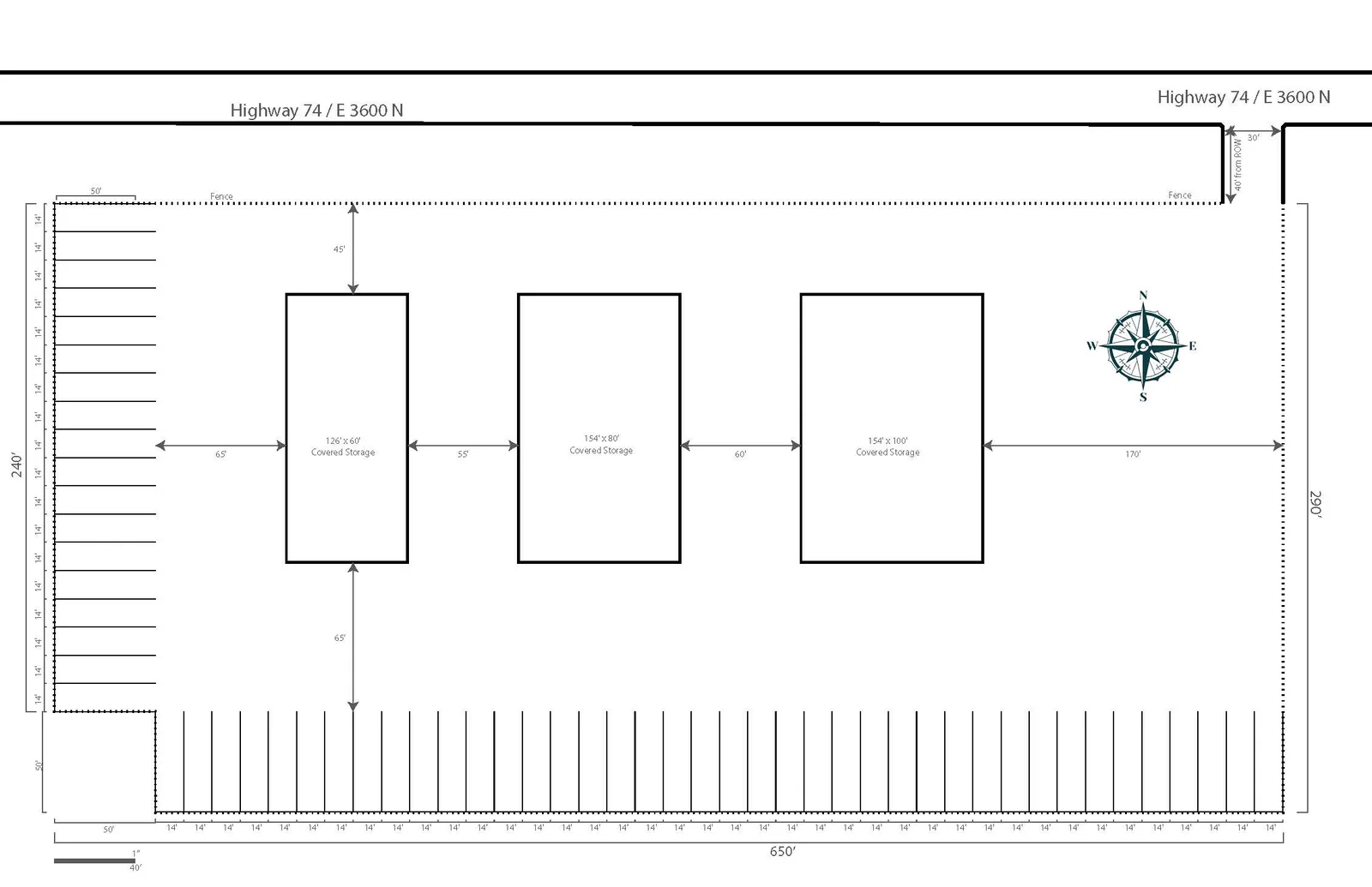
- Scaled drawings with dimensions and a north arrow, for customers, signage, or to go with a permit application. I can’t promise a permit will be approved, but I’m glad to help put the drawing together for one.
- Interactive versions
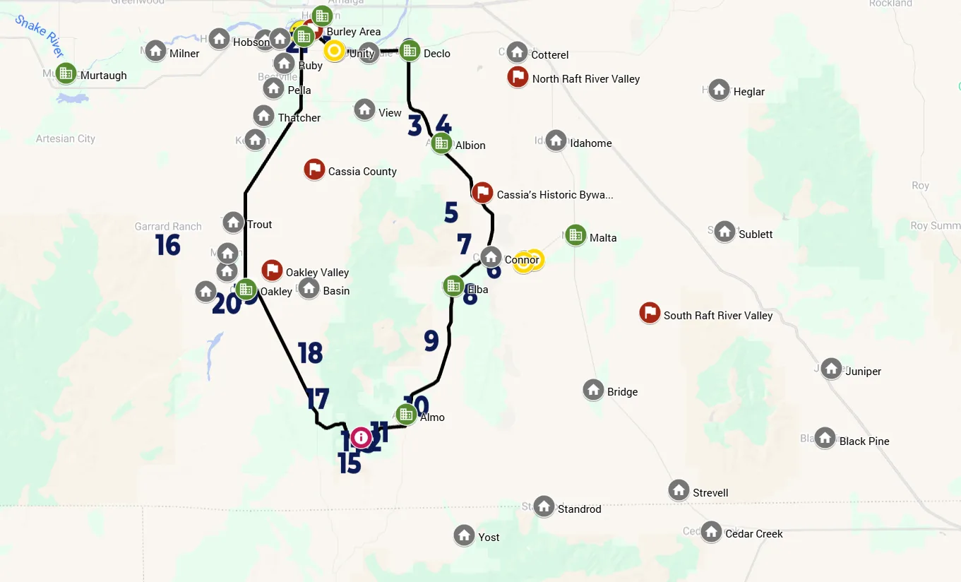
- A Google My Maps version with numbered stops and a driving route opens on any phone. The Cassia County driving tour — an interactive version of a printed map — has been viewed more than 3,400 times.
- Web images
- The finished map in whatever format and size you need for a website, social media, or email.
What it costs
Every map is quoted once I know what it needs to do.
I price a map on the assumption that you bring the content: the boundaries you want covered, the sites that go on the sheet, and the words that go with them. That part you know better than I ever will — you have the historical society, the archives, and the people who remember. I make the map. If you need me to gather it instead, that’s research at my hourly rate on top of the design, estimated before I start.
What moves the price:
- Size and density
- A 24 × 36 with sixty sites takes longer than a page map with ten.
- Research
- The design price assumes the sites and history come from you. If I gather them, that’s hourly on top.
- Illustration
- Whether the artwork already exists or has to be made.
- Printing
- Whether I hand off files or source and manage the print run.
The fastest version of this is the one where you arrive with your boundaries drawn and your content written. When that happens I can have a first draft back inside a week.
Examples
Print · Maps · Web
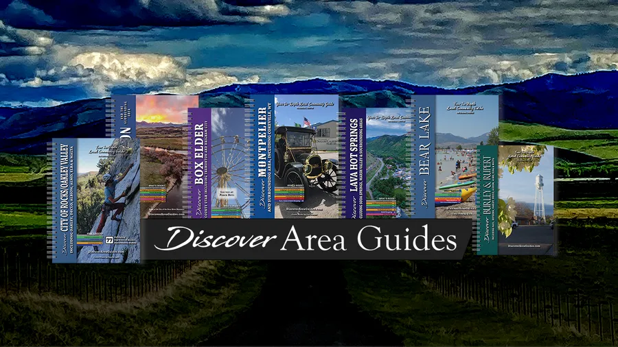
Discover Area Guides
Eight years as the whole design and production side of a regional guide publisher — more than 50 guides, a map series, and two websites.
Maps
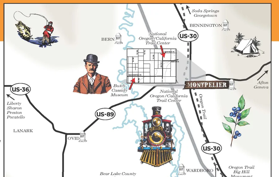
Bear Lake historical sites
A 24×36 historical map of the valley, printed on Tiga stock and sold through businesses around Bear Lake.
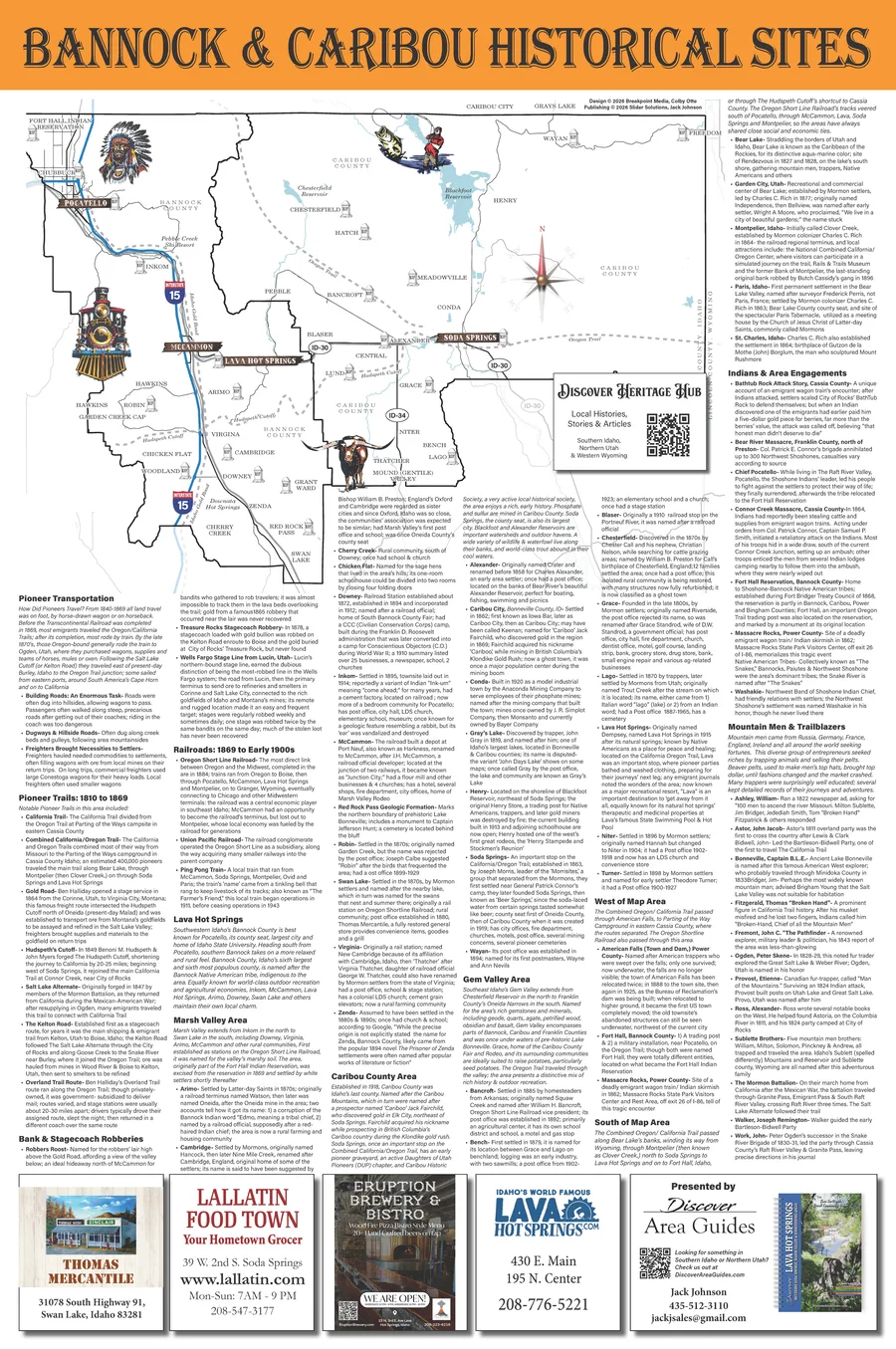
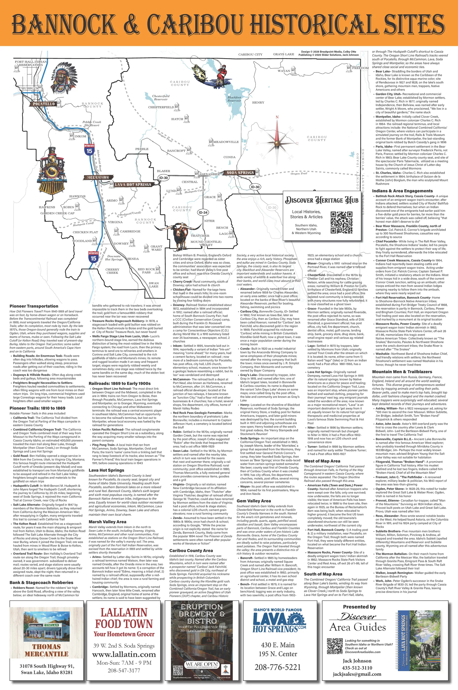
Bannock & Caribou historical sites A 24×36 wall map of Lava Hot Springs, Soda Springs, Pocatello, and the country between. Illustrations by Laura Ashliman. 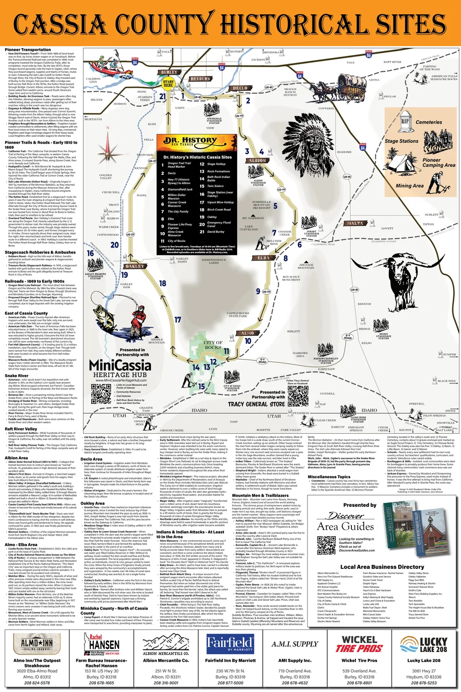
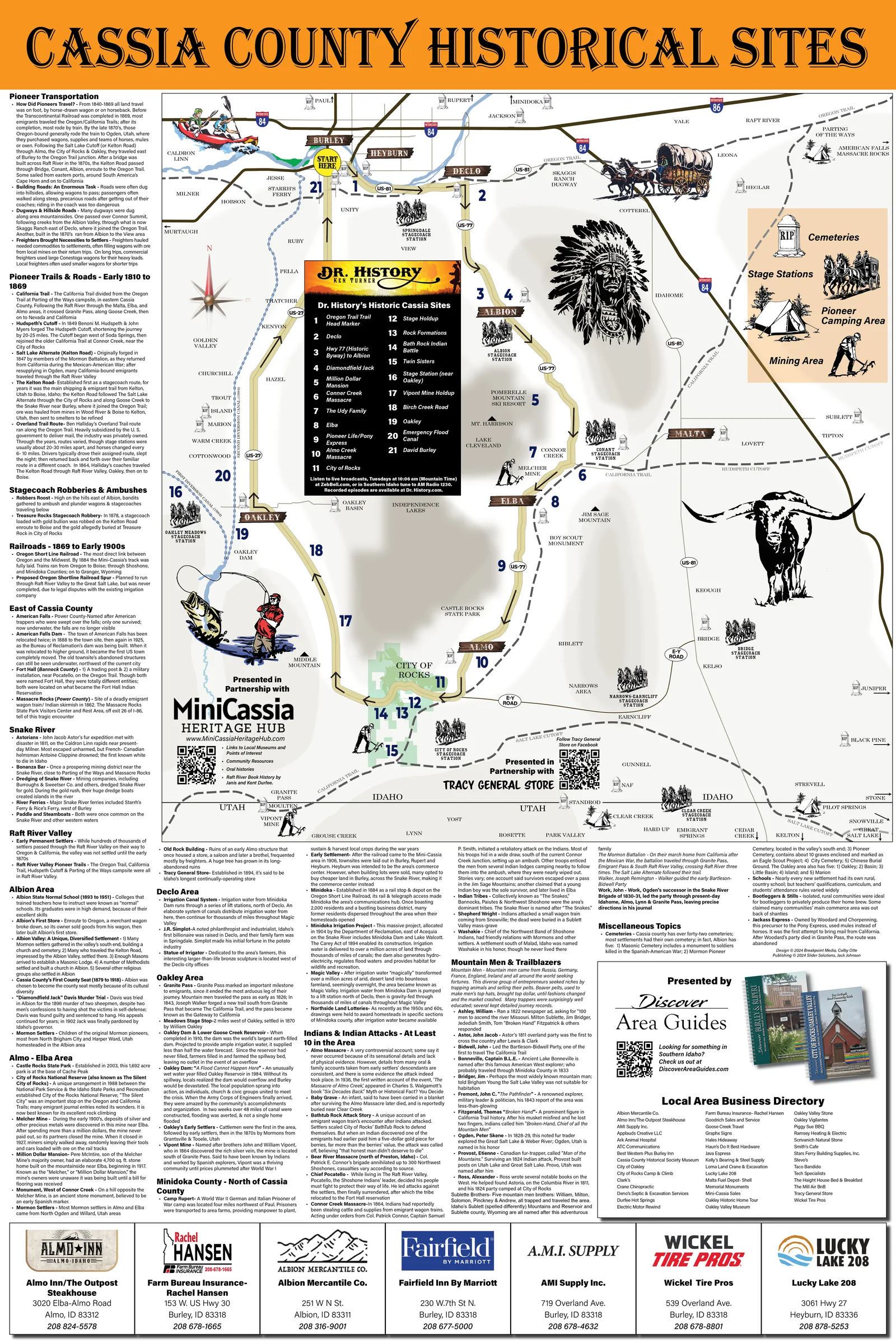
Cassia County historical sites The Mini-Cassia map — pioneer trails, stagecoach stations and ghost towns, with the site histories set around the map. Illustrations by Laura Ashliman.View the full map (opens in a new tab) 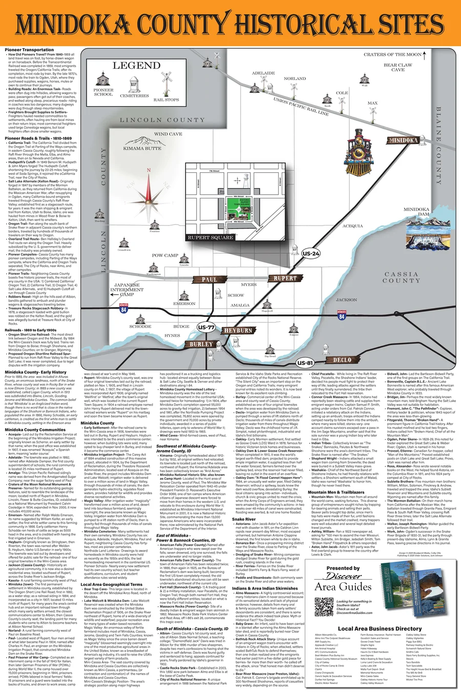
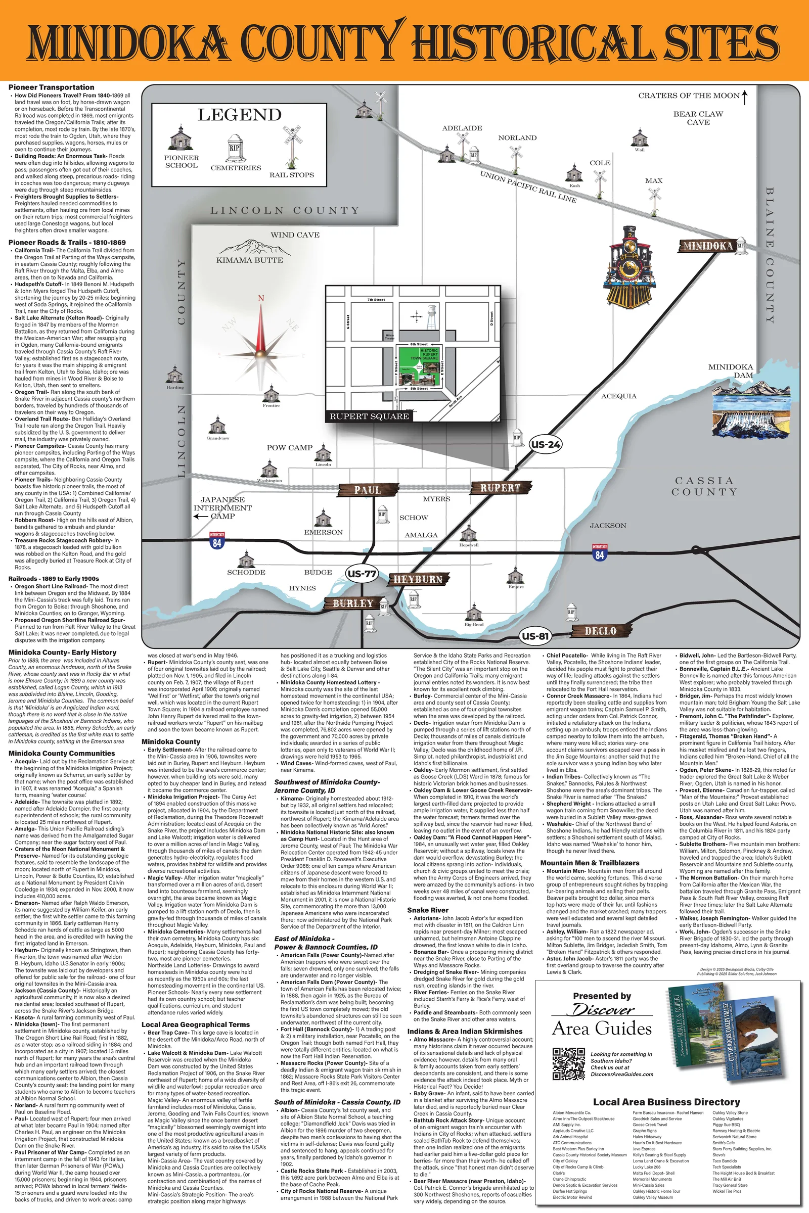
Minidoka County historical sites Minidoka County, from the dam to the rail towns. Illustrations by Laura Ashliman. 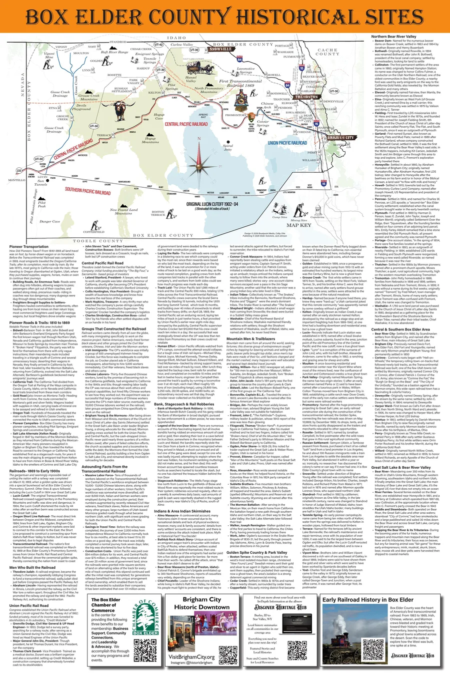
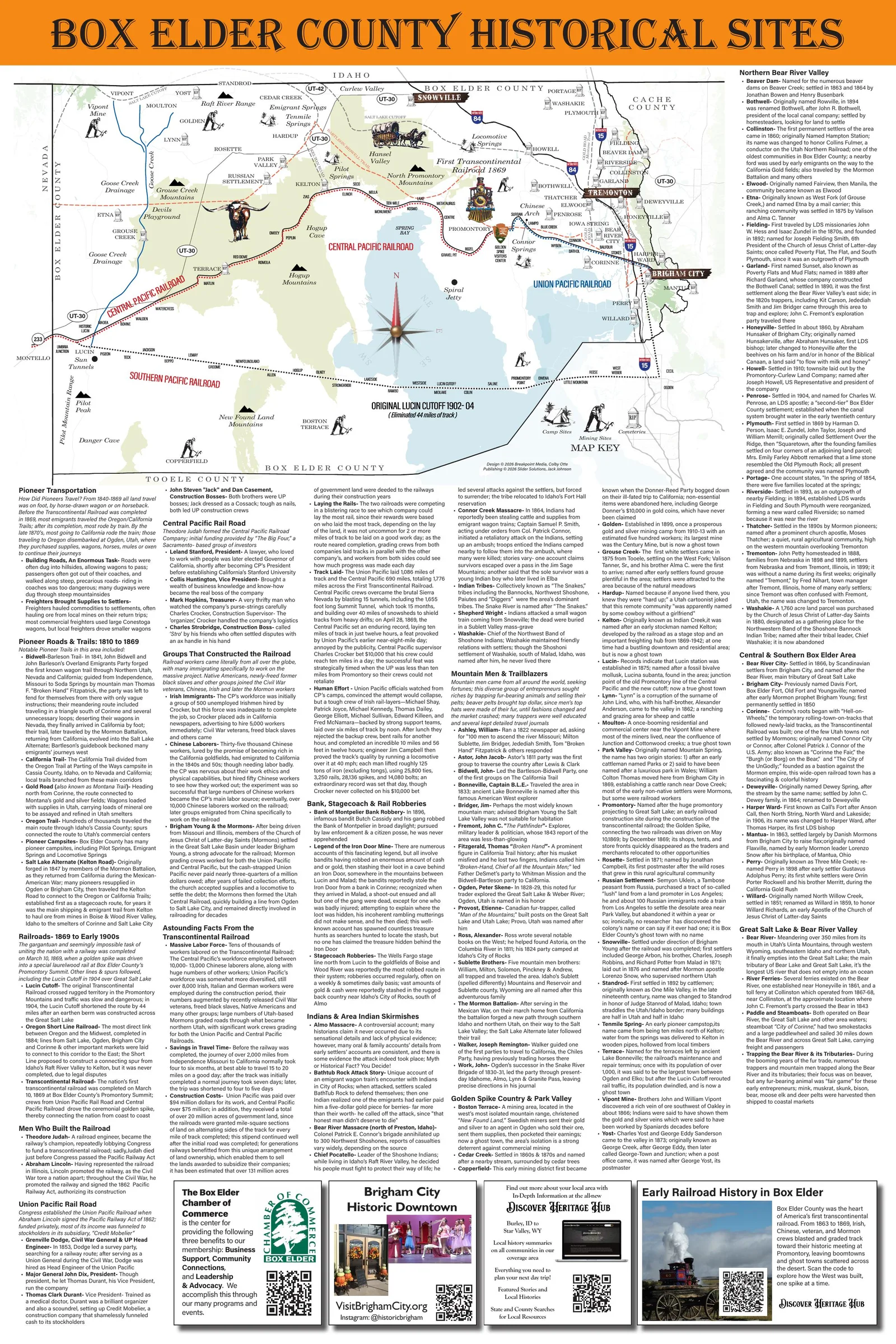
Box Elder County historical sites Box Elder County — the Golden Spike country, Brigham City and the route west. Illustrations by Laura Ashliman. 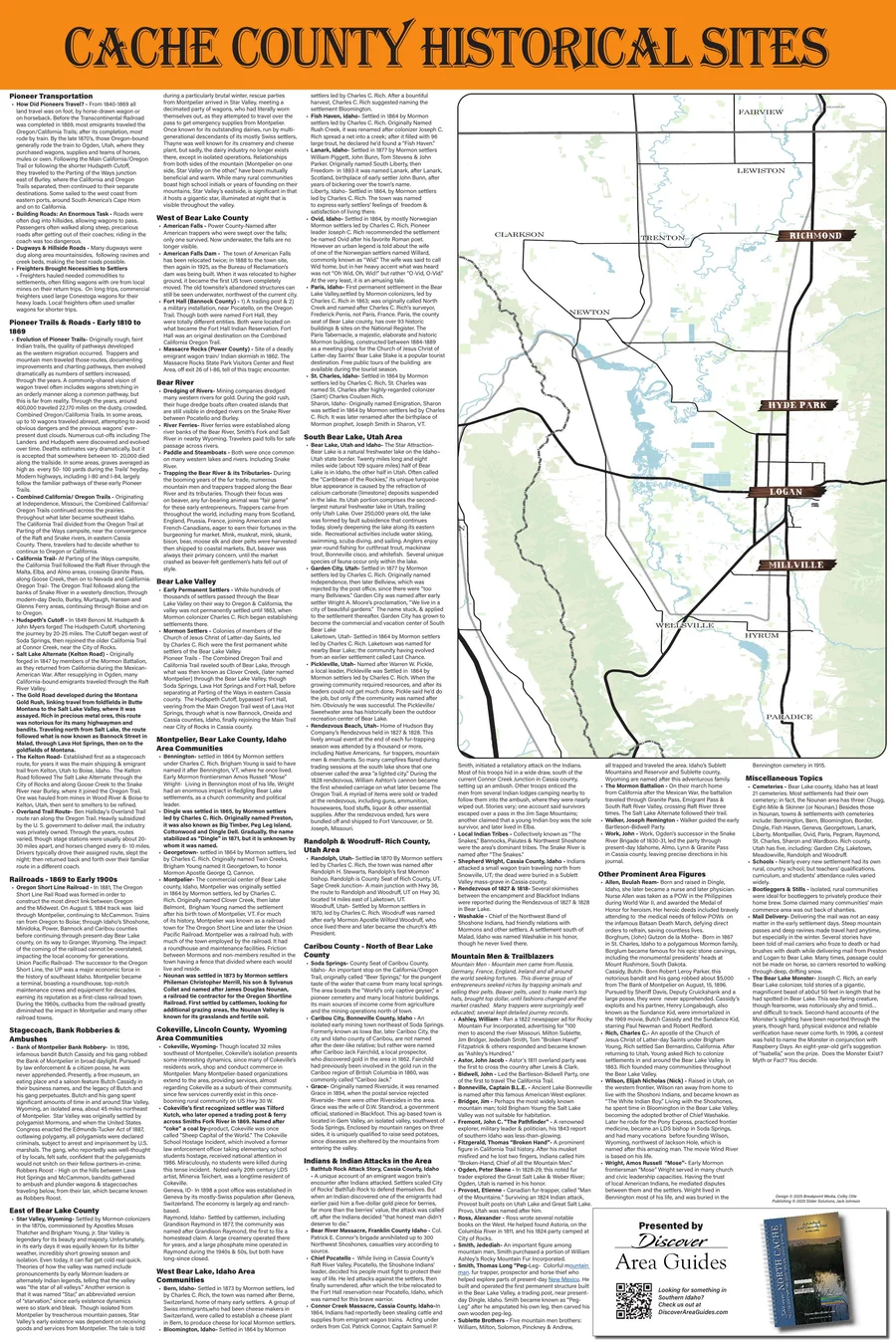
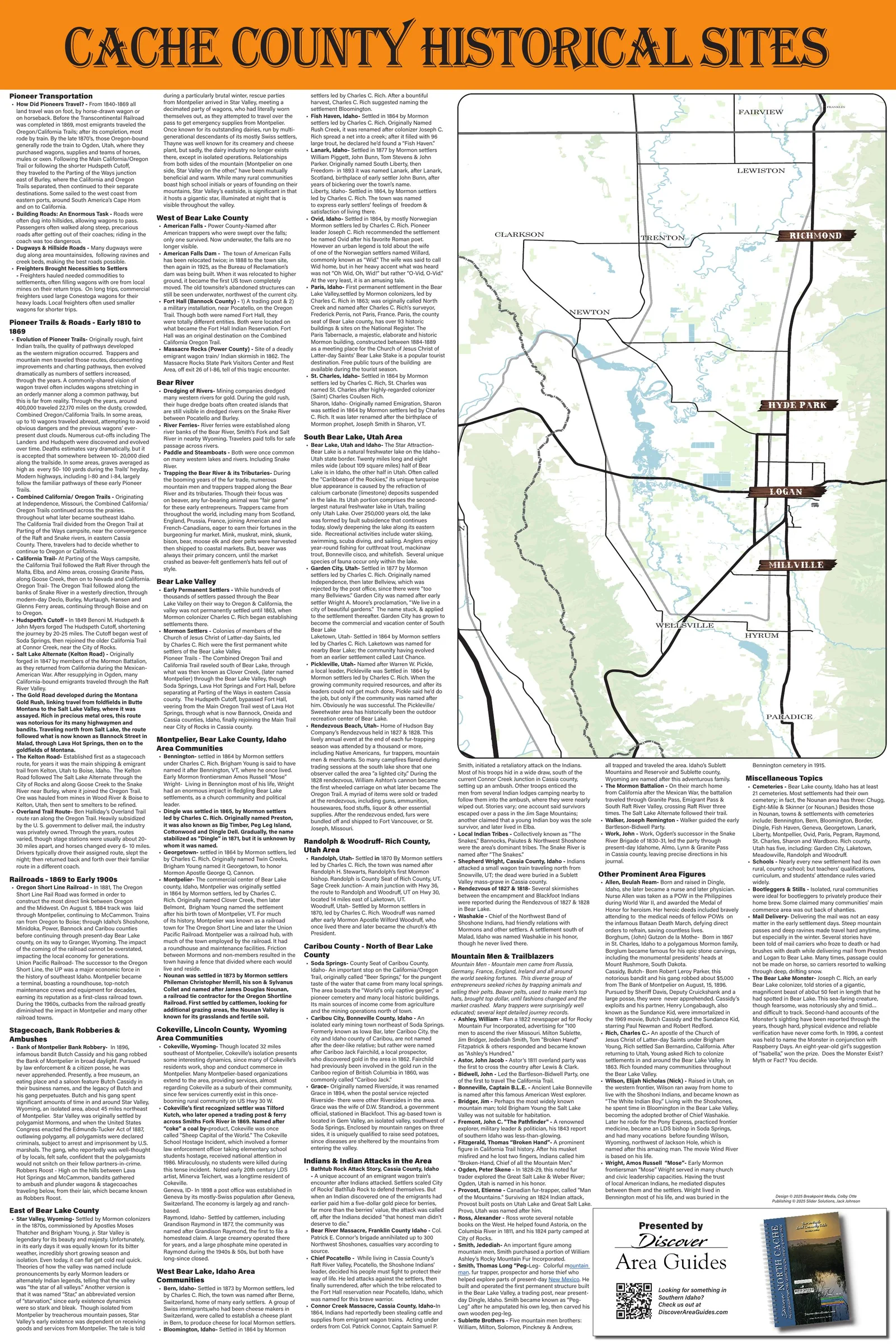
Cache County historical sites Cache Valley, its settlements and the canyons between them. Illustrations by Laura Ashliman. 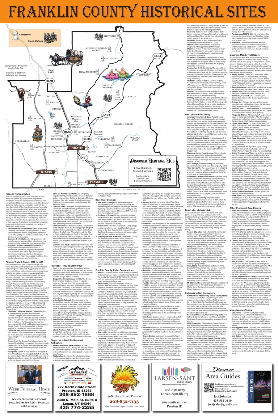
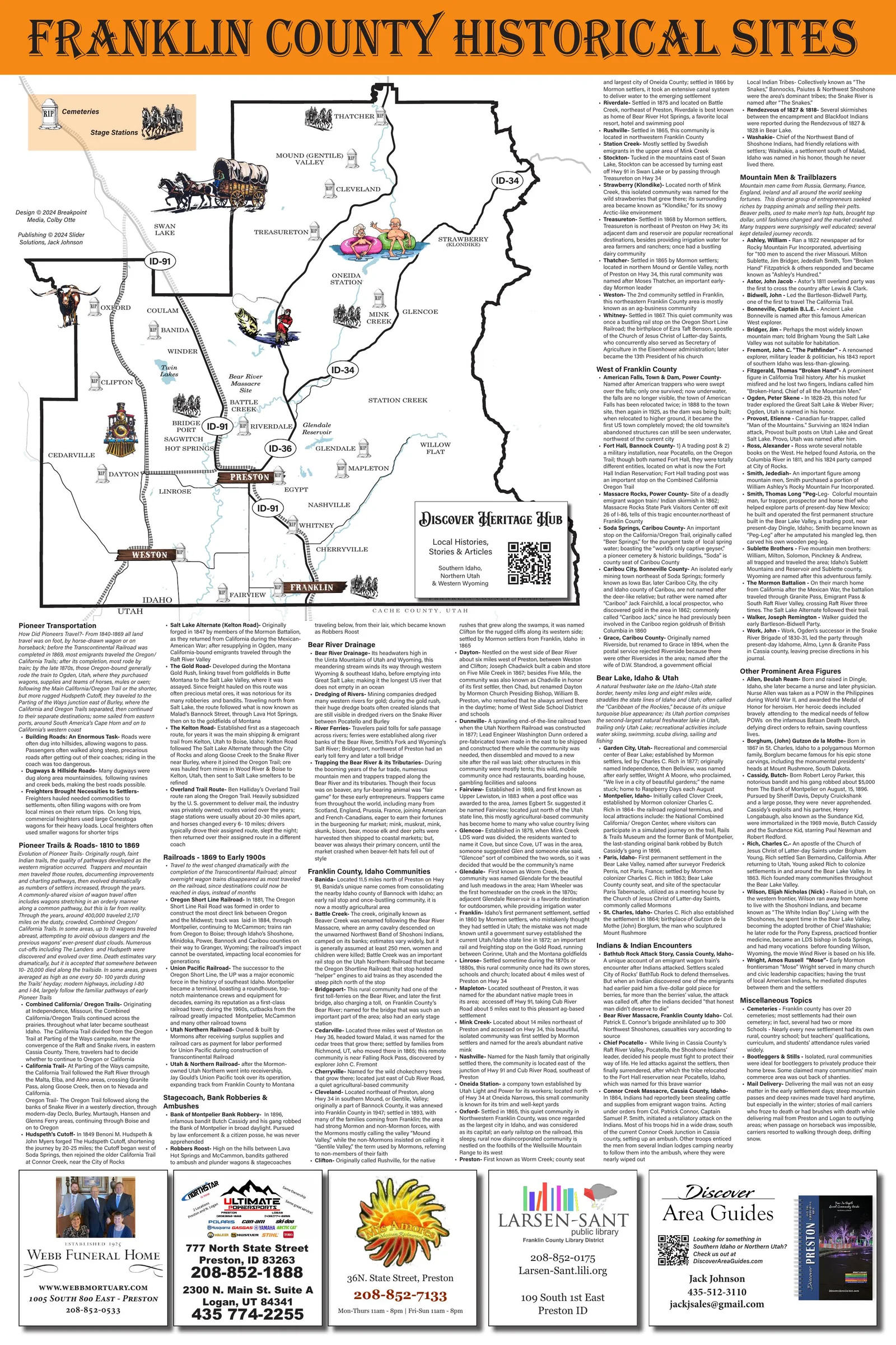
Franklin County historical sites Franklin County, Idaho’s oldest settlement and the country around it. Illustrations by Laura Ashliman. 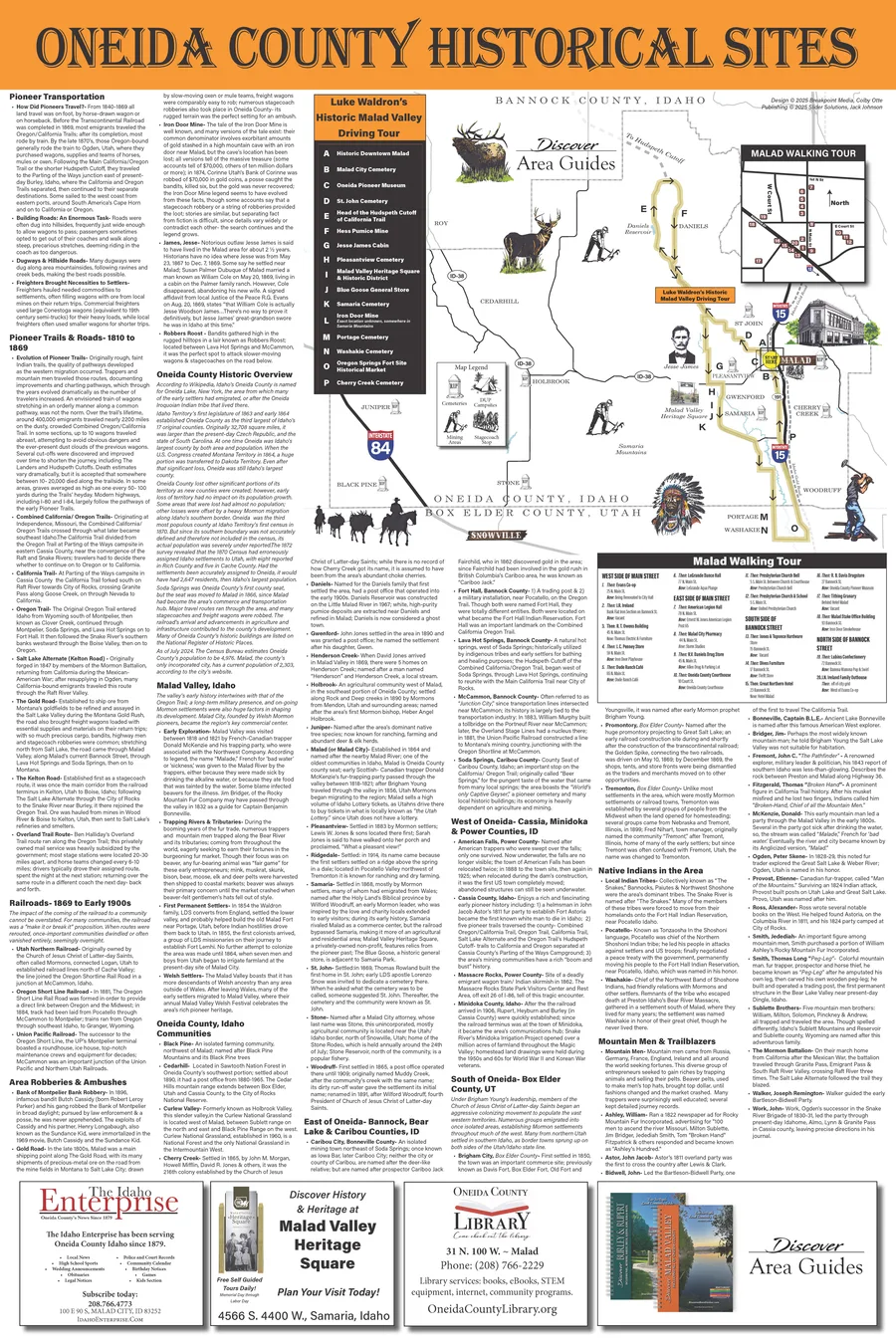
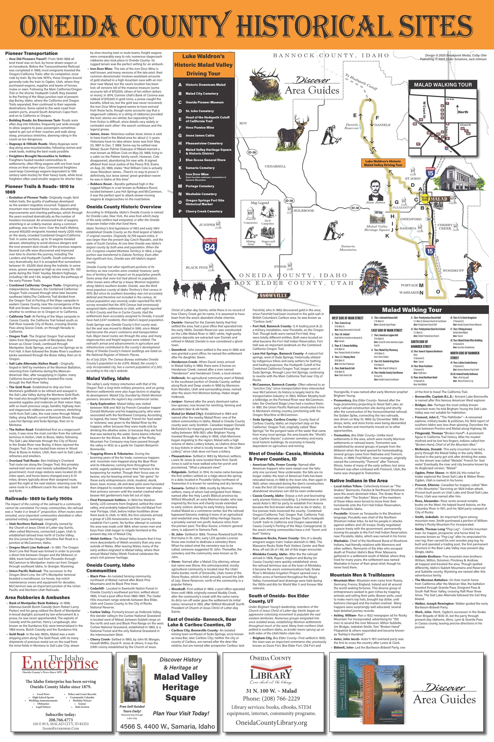
Oneida County historical sites Oneida County and the Malad Valley, with a downtown walking tour set into the sheet. Illustrations by Laura Ashliman. 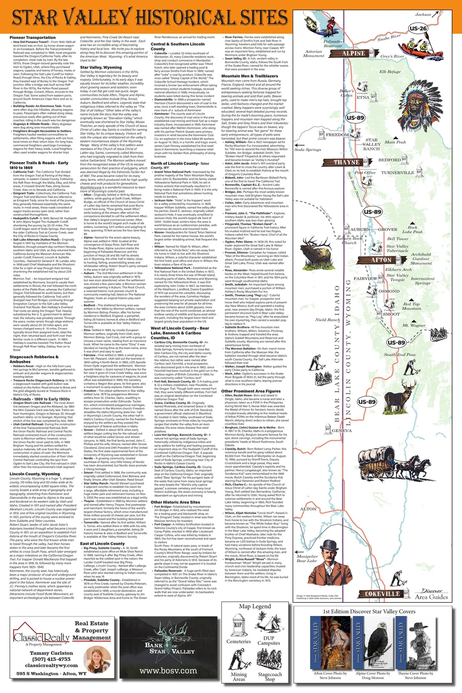
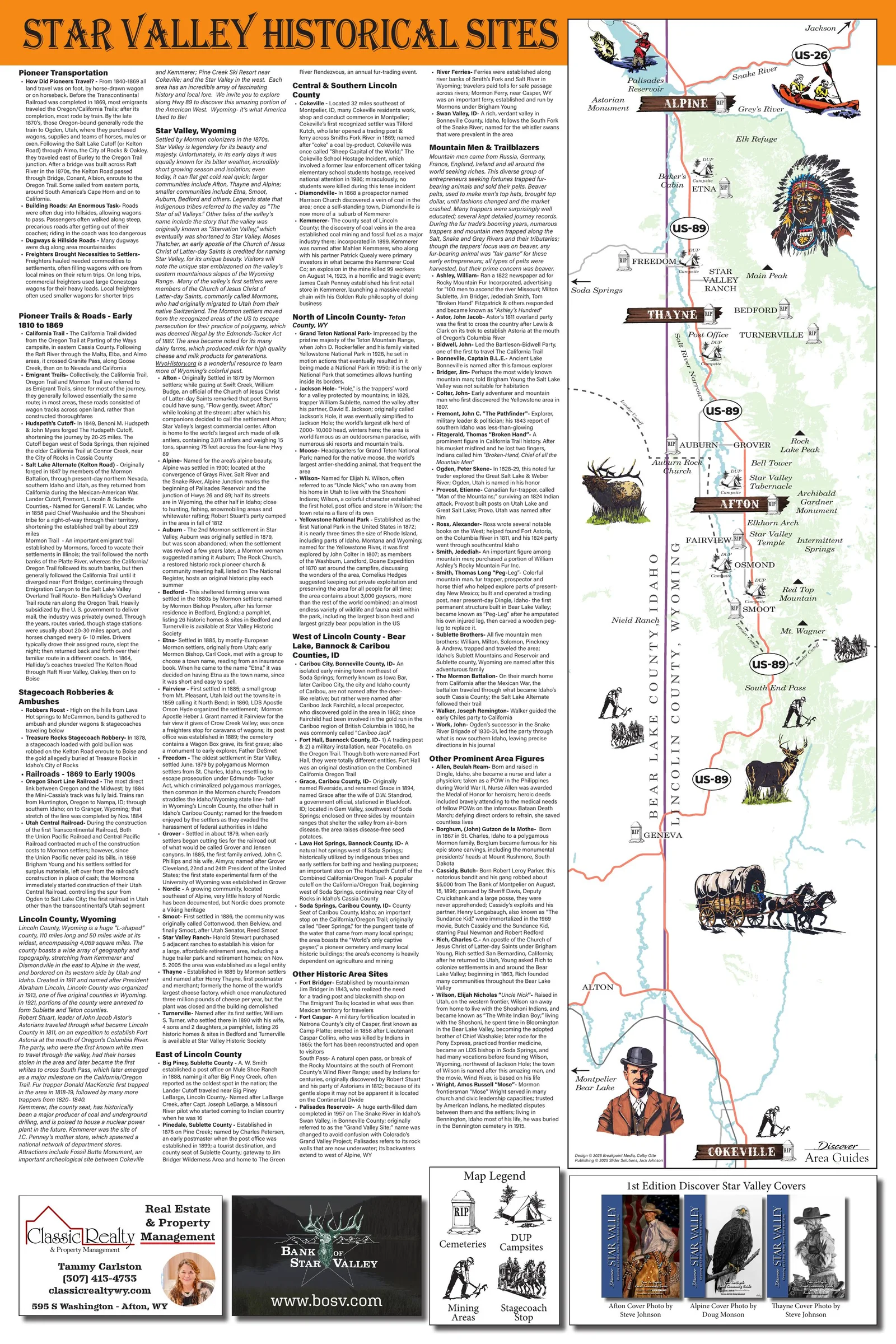
Star Valley historical sites Star Valley, Wyoming, end to end. Illustrations by Laura Ashliman.View the full map (opens in a new tab) 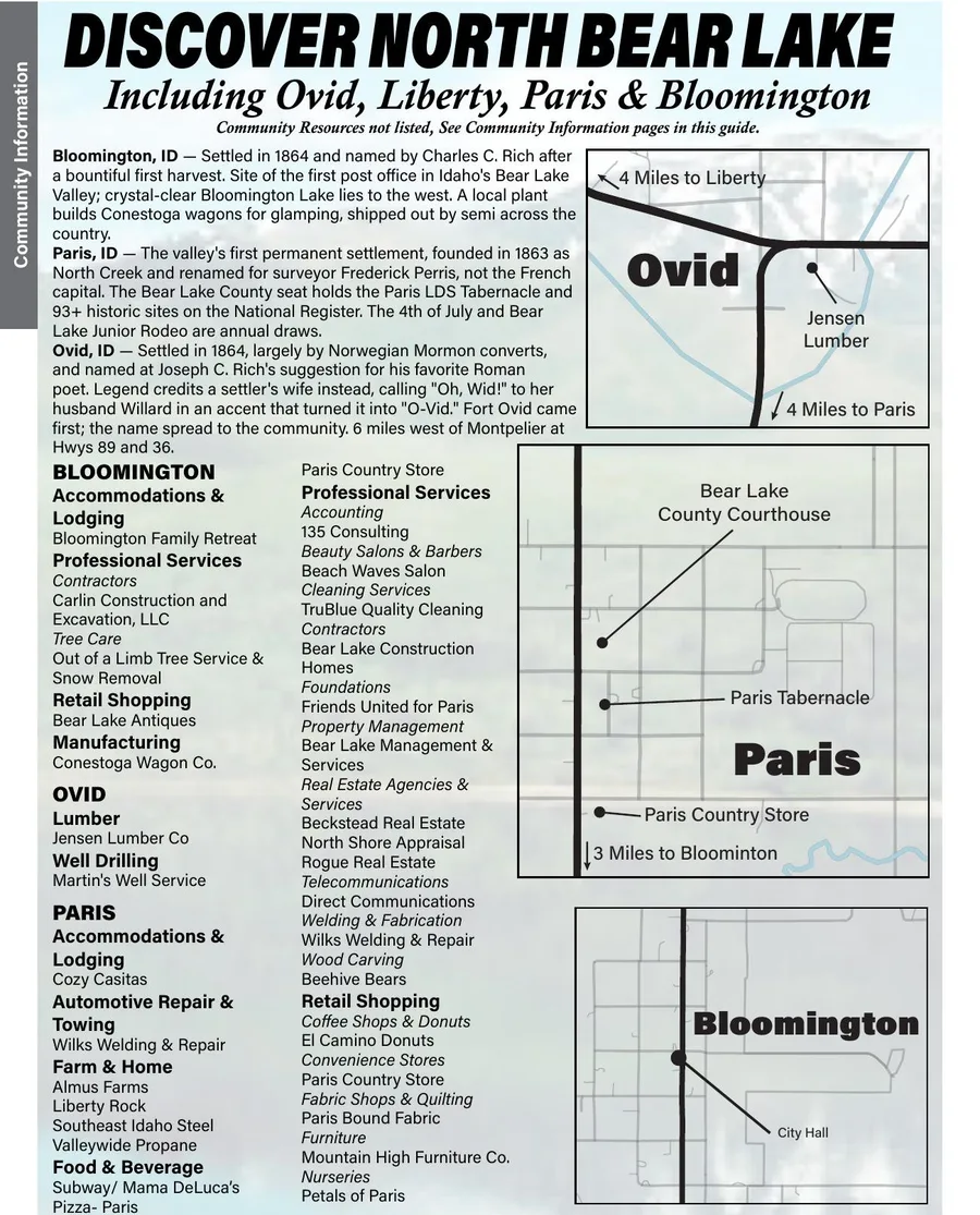
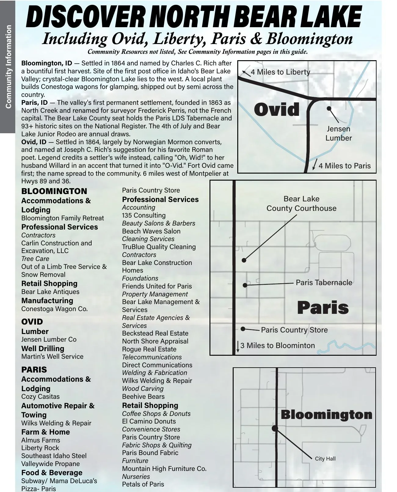
Discover North Bear Lake The north end of the valley — Ovid, Liberty, Paris and Bloomington — with each town’s history and directory set beside the map. 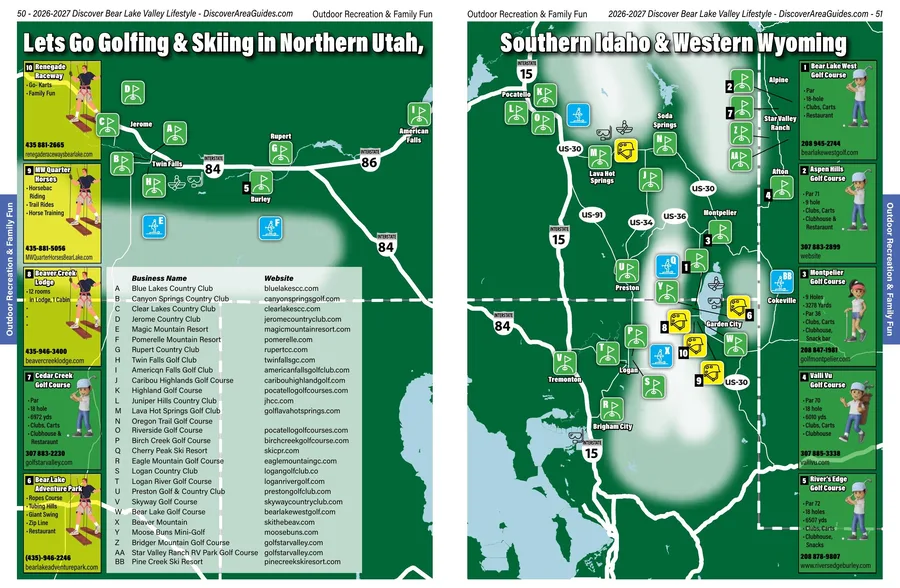
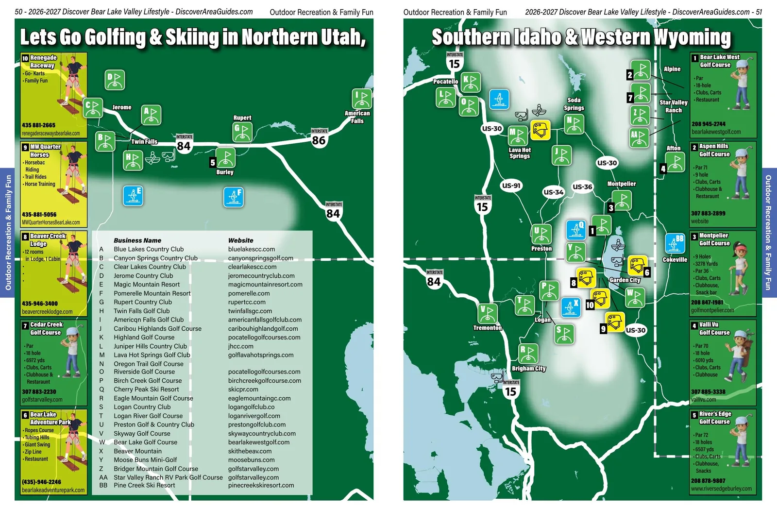
Golf and ski map A two-page recreation map running from northern Utah through southern Idaho into western Wyoming, courses and resorts numbered and keyed to the list alongside. 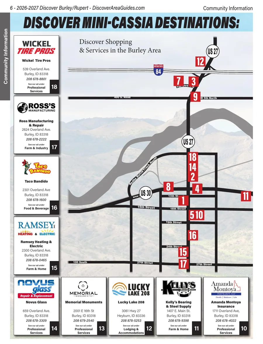
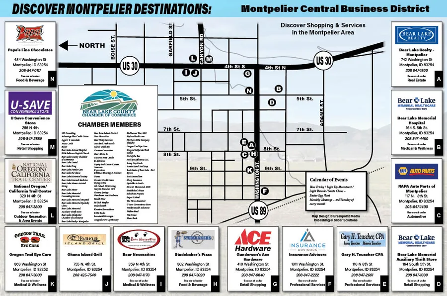
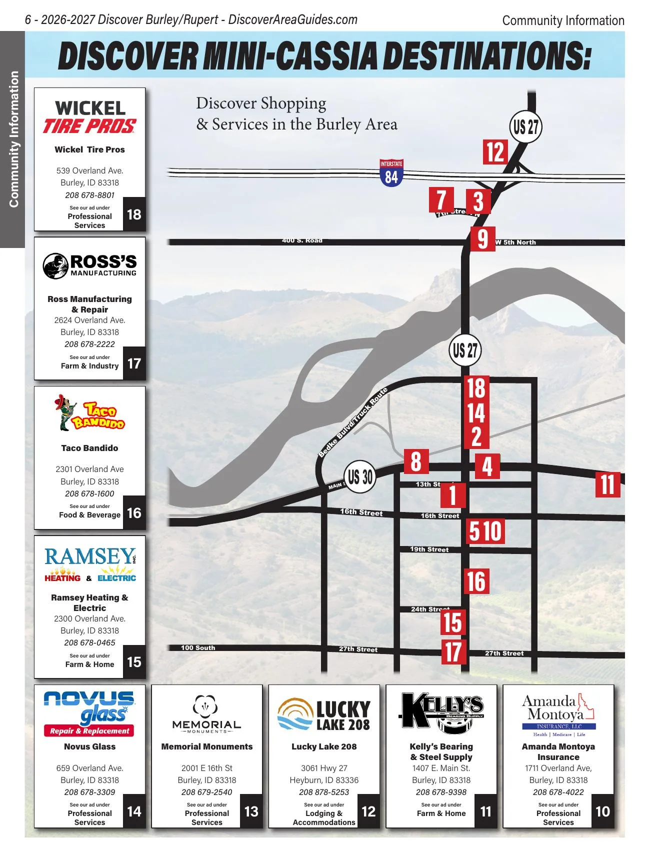
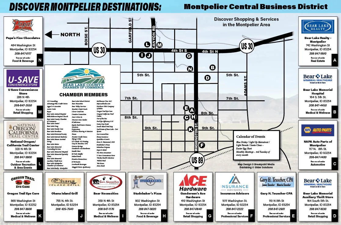
Discover Mini-Cassia destinations The Burley shopping and services map from the guide, with advertisers keyed to numbered locations. Montpelier downtown Wayfinding map of Montpelier’s central business district for the Discover Area Guides series. 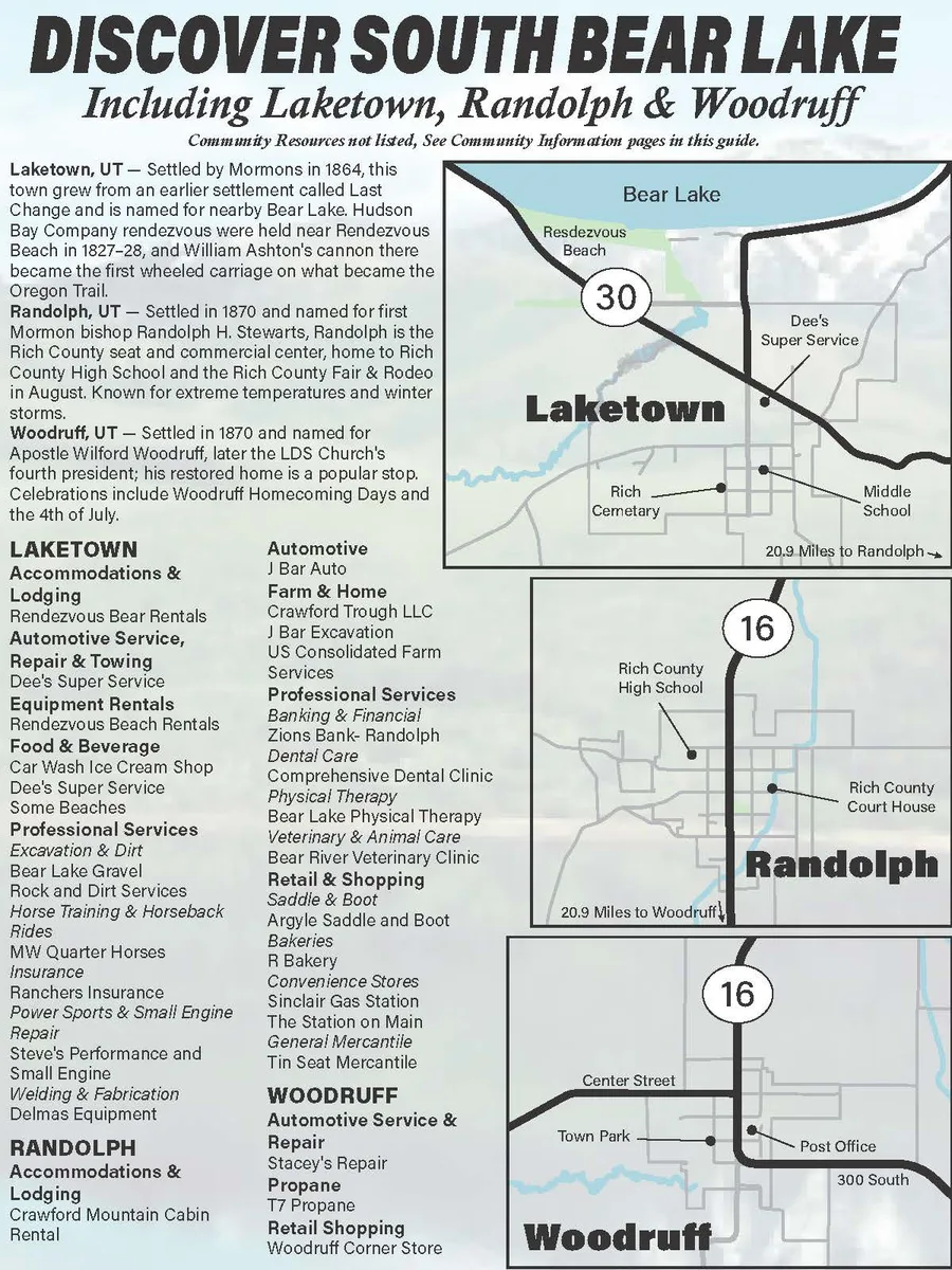
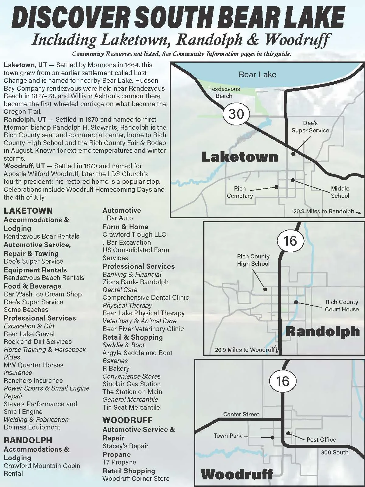
Discover South Bear Lake Map page for Laketown, Randolph and Woodruff in the Discover Bear Lake guide, with each town’s history and a business directory. 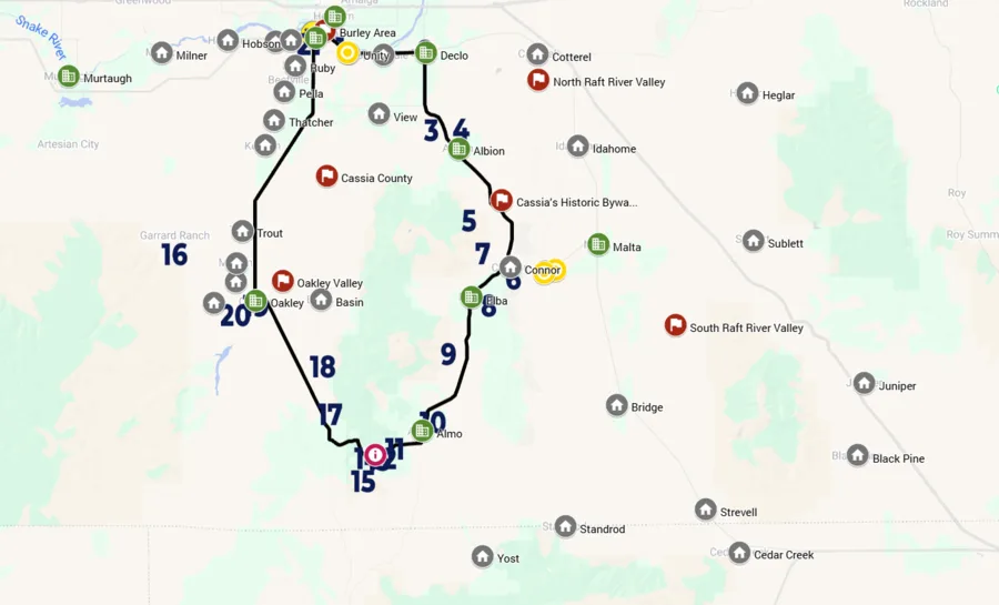
Cassia County driving tour An interactive version of the Cassia County map poster for Discover Area Guides, built in Google My Maps. Viewed more than 3,400 times. 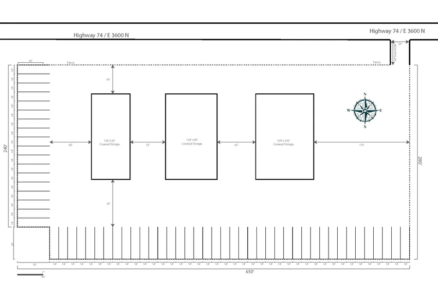
Facility layout A scaled facility plan with dimensions and a compass rose, laid out to drafting conventions for a local business.
Questions
How long does a map take?
A simple map can be done in a couple of days. A detailed wall map usually takes four to six weeks, depending on how many sites it covers and whether new illustration is needed.
What do you need from me to start?
The area the map covers, what it’s for, the size, and whatever you have on the sites you want on it — a list, notes, the history, photos. It doesn’t need to be organized.
Can you work from an existing map or rough sketch?
Yes. A rough sketch is often the fastest way to show me what matters to you. If there’s an older map you want replaced, send it and I’ll use it as a reference, not a template.
Do I own the artwork?
Once the final invoice is paid, the finished map is yours to print, publish, and use however you like, and you get the final files in whatever formats you need. The working Illustrator and InDesign files aren’t included by default. If the map uses artwork from an outside illustrator, the terms for that artwork are agreed before we start.
Can it be used both in print and on a website?
Yes. You get web versions as PNG, JPG, or whatever else you need. The Cassia County map started as a printed poster and got an interactive Google My Maps version that’s been viewed more than 3,400 times.
Do you handle printing?
Yes. I’d rather source the printing myself so I can see it through to the finished sheet, but if you already have a printer, I’ll deliver files built to their specifications.
Have a place that needs a map?
Tell me what it’s for and roughly what it covers. I’ll tell you what it would take.